|
Rocky_Ridge.pdf 2.86 Mb 16 pages At one meter per pixel, the 2411 x 2138 map is very large. Although it can be printed on a common printer, the text is too small to easily read. This PDF file breaks the map into 16 pages which can be printed, trimmed, and joined together to form a map about 26"x26". Great for those tactical ATV rides.. |
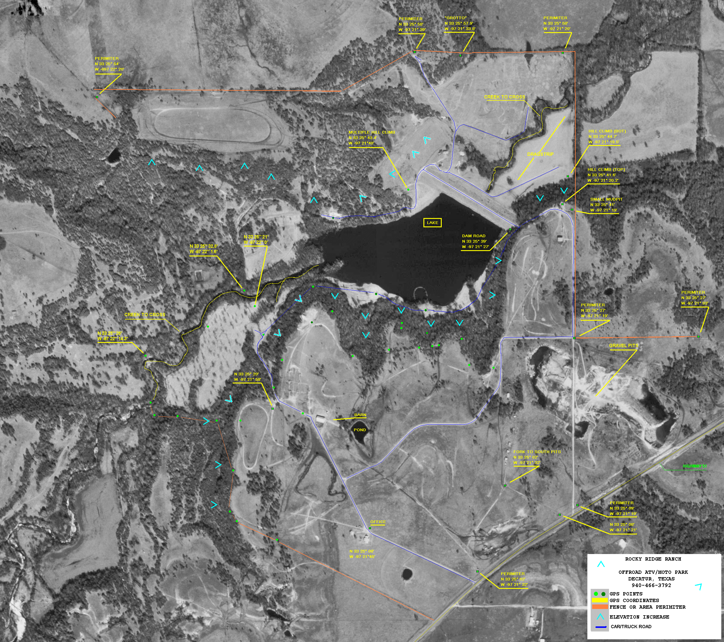 Rocky_Ridge_1pixmeter_NAV.GIF 2.56 Mb 2411 x 2138 High resolution GIF image of Rocky Ridge |
 Rocky_Ridge_1pixmeter_NAV.jpg 1.48 Mb 2411 x 2138 High resolution JPEG image of Rocky Ridge |
map_rocky_ridge.pdf 77 Kb 2 pages Highway Directions to rocky ridge from Sanger, TX on I-35 |